
File:Charcot Island, Antarctica.png
本预览的尺寸:697 × 600像素。 其他分辨率:279 × 240像素 | 558 × 480像素 | 925 × 796像素。
原始文件 (925 × 796像素,文件大小:441 KB,MIME类型:image/png)
摘要
| 描述 |
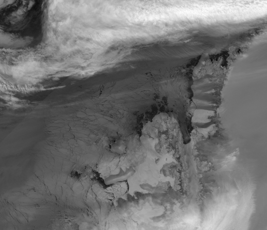
English: This image is made from thermal infra-red data collected by the Moderate Resolution Imaging Spectroradiometer (MODIS) on NASA’s Terra satellite. (A photo-like image isn’t possible at this latitude in the winter because of polar darkness). This greyscale image shows relative differences in surface temperature. Dark grey indicates relatively warm temperatures and white indicates relatively cold temperatures. Remnant ice shelf east of Latady Island appears white, as does some of the sea ice between Charcot and Latady Islands. Charcot Island’s nearly black perimeter indicates an area of relatively open ocean that could be navigated by ship. In addition, an area of relatively warm ocean water appears off the western end of Latady Island. |
| 日期 | |
| 来源 | NASA Earth Observatory |
| 作者 | Jesse Allen |
Data obtained from the Goddard Level 1 and Atmospheric Archive and Distribution System (LAADS). Image interpretation by Ted Scambos, National Snow and Ice Data Centre. Instrument: Terra - MODIS.
许可协议
| 本文件完全由NASA创作,在美国属于公有领域。根据NASA的版权方针,NASA的材料除非另有声明否则不受版权保护。(参见Template:PD-USGov/zh、NASA版权方针页面或JPL图片使用方针。) | ||
 |
警告:
|
文件历史
点击某个日期/时间查看对应时刻的文件。
| 日期/时间 | 缩略图 | 大小 | 用户 | 备注 | |
|---|---|---|---|---|---|
| 当前 | 2009年8月14日 (五) 09:02 | | 925 × 796(441 KB) | Originalwana | {{Information |Description={{en|1=This image is made from thermal infra-red data collected by the Moderate Resolution Imaging Spectroradiometer (MODIS) on NASA’s Terra satellite. (A photo-like image isn’t possible at this latitude in the winter becaus |
文件用途
全域文件用途
以下其他wiki使用此文件:
- ceb.wikipedia.org上的用途
- en.wikipedia.org上的用途
- es.wikipedia.org上的用途
- he.wikipedia.org上的用途
- it.wikipedia.org上的用途
- ja.wikipedia.org上的用途
- lld.wikipedia.org上的用途
- nn.wikipedia.org上的用途
- sv.wikipedia.org上的用途
- www.wikidata.org上的用途