
File:Monashee Mountains2.jpg
原始文件 (1,155 × 1,192像素,文件大小:780 KB,MIME类型:image/jpeg)
摘要
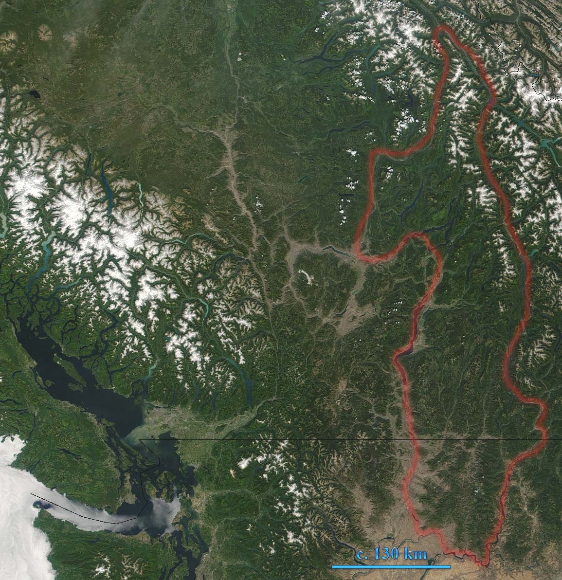
Monashee Mountains in British Columbia, Canada are indicated. The boundary shown includes the Okanagan Highland and the southeastern Shuswap Highland, which are sometimes reckoned to be part of the Interior Plateau. This true-color MODIS image shows southern British Columbia. In the left of the image lies Vancouver Island, which is separated from Washington by the Juan de Fuca Strait. British Columbia's glacier-capped Coast Mountain Range runs northwest-southeast inland from Vancouver Island.
Source: [1] archive copy at the Wayback Machine
Modified by User:Skookum1 from original Image:Monashee Mountains.jpg- image brightened for better visibility
许可协议
| 本文件完全由NASA创作,在美国属于公有领域。根据NASA的版权方针,NASA的材料除非另有声明否则不受版权保护。(参见Template:PD-USGov/zh、NASA版权方针页面或JPL图片使用方针。) | ||
 |
警告:
|
文件历史
点击某个日期/时间查看对应时刻的文件。
| 日期/时间 | 缩略图 | 大小 | 用户 | 备注 | |
|---|---|---|---|---|---|
| 当前 | 2007年1月9日 (二) 22:26 | | 1,155 × 1,192(780 KB) | Skookum1 | Monashee Mountains in British Columbia, Canada are indicated. This true-color MODIS image shows southern British Columbia. In the left of the image lies Vancouver Island, which is separated from Washington by the Juan de Fuca Strait. British Columbia's gl |
文件用途
以下页面使用本文件:
全域文件用途
以下其他wiki使用此文件:
- en.wikipedia.org上的用途