
File:Paris Arc de Triomphe Bataille d'Aboukir.jpg

本预览的尺寸:800 × 444像素。 其他分辨率:320 × 177像素 | 640 × 355像素 | 1,024 × 568像素 | 1,280 × 710像素 | 2,560 × 1,420像素 | 4,398 × 2,439像素。
原始文件 (4,398 × 2,439像素,文件大小:2.93 MB,MIME类型:image/jpeg)
摘要
| 描述 |
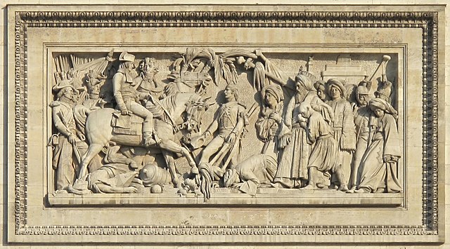
English: The Arc de Triomphe de l'Étoile in Paris, seen from the Champs-Élysées. Upper relief of the left : battle of Aboukir 25 jul 1799 by Bernard Seure.
Français : L'Arc de Triomphe de l'Étoile à Paris, vu depuis les Champs-Élysées. Le bas-relief supérieur de gauche : La bataille d'Aboukir 25/7/1799 par Bernard Seure. |
| 日期 | |
| 来源 | 自己的作品 |
| 作者 | Tangopaso |
| 相机位置 | | 在以下服务上查看本图像和附近其他图像: OpenStreetMap |
|---|
许可协议
| 我,本作品著作权人,释出本作品至公有领域。这适用于全世界。 在一些国家这可能不合法;如果是这样的话,那么: 我无条件地授予任何人以任何目的使用本作品的权利,除非这些条件是法律规定所必需的。 |
文件历史
点击某个日期/时间查看对应时刻的文件。
| 日期/时间 | 缩略图 | 大小 | 用户 | 备注 | |
|---|---|---|---|---|---|
| 当前 | 2013年10月9日 (三) 05:59 | | 4,398 × 2,439(2.93 MB) | Paris 16 | |
| 2013年10月9日 (三) 05:10 |  | 4,405 × 2,447(2.99 MB) | Paris 16 | ||
| 2011年5月17日 (二) 20:12 |  | 4,416 × 3,312(1.25 MB) | Tangopaso | Better image, because photo taken in front of the relief | |
| 2011年5月9日 (一) 21:11 |  | 4,416 × 3,312(1.16 MB) | Tangopaso | == {{int:filedesc}} == {{Information |Description= {{en|1=The Arc de Triomphe de l'Étoile in Paris, seen from the Champs-Élysées. Upper relief of the right : Funerals of the général Marceau 20 sep 1796 by Philippe Joseph Henri Lemaire.}} {{fr|1=L'Arc |
文件用途
以下页面使用本文件:
全域文件用途
以下其他wiki使用此文件:
- ca.wikipedia.org上的用途
- ce.wikipedia.org上的用途
- en.wikipedia.org上的用途
- es.wikipedia.org上的用途
- fa.wikipedia.org上的用途
- fi.wikipedia.org上的用途
- fr.wikipedia.org上的用途
- it.wikipedia.org上的用途
- ja.wikipedia.org上的用途
- ko.wikipedia.org上的用途
- ms.wikipedia.org上的用途
- pl.wikipedia.org上的用途
- ru.wikipedia.org上的用途
- sh.wikipedia.org上的用途
- sl.wikipedia.org上的用途
- vi.wikipedia.org上的用途