
File:Rim of Bopolu Crater 2010.jpg
原始檔案 (1,330 × 1,203 像素,檔案大小:761 KB,MIME 類型:image/jpeg)
摘要
| 描述 |
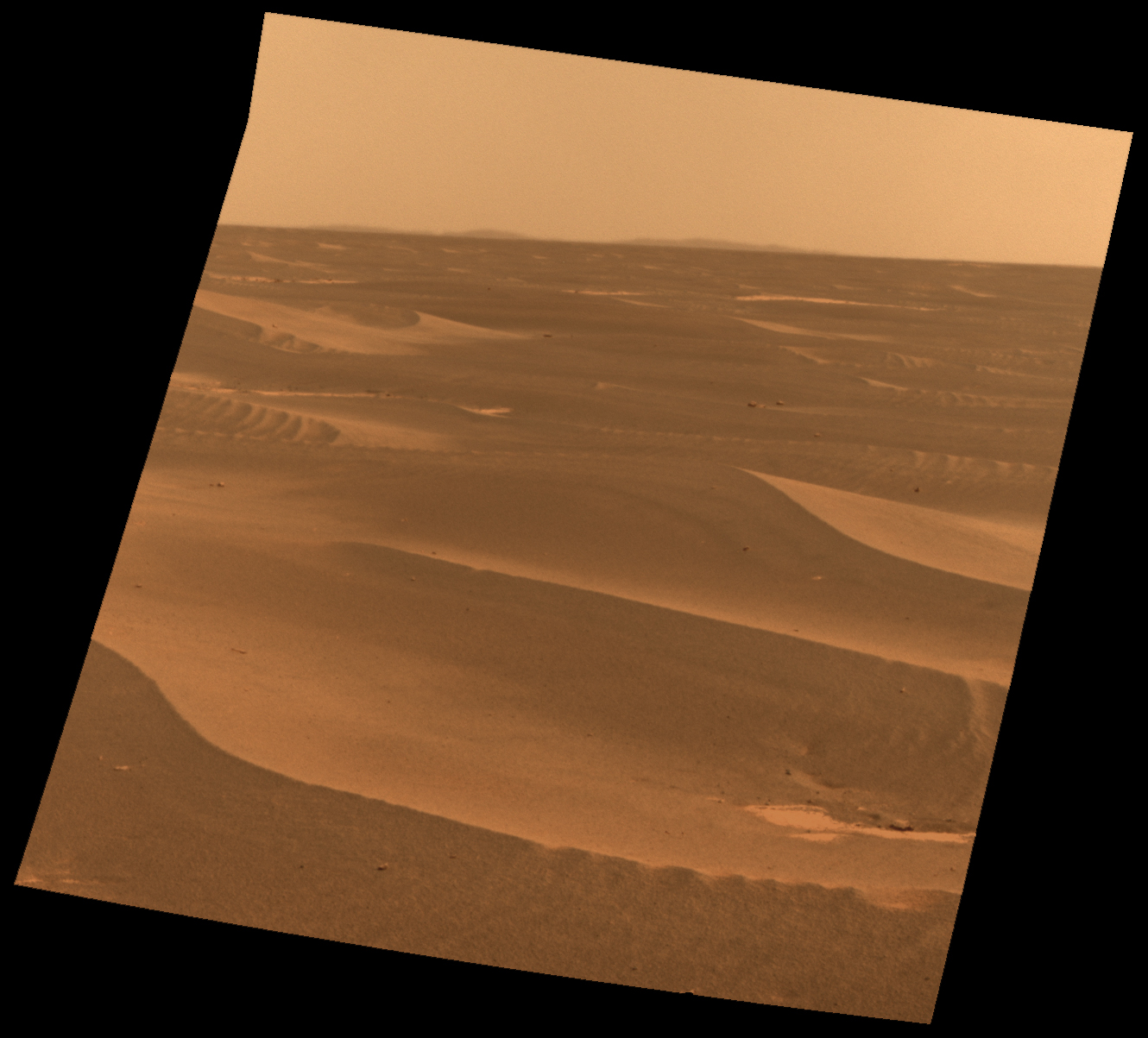
http://www.nasa.gov/images/content/435507main_pia12980-full.jpg http://www.nasa.gov/mission_pages/mer/images/pia12980.html NASA's Mars Exploration Rover used its panoramic camera to record this view of the rim of a crater about 65 kilometers (40 miles) in the distance, on the southwestern horizon. This crater, Bopolu, is about 19 kilometers (12 miles) in diameter. The image was taken during the 2,179th Martian day, or sol, of Opportunity's mission on Mars (March 11, 2010), two days after the rover drove southward away from Concepcion crater, site of several weeks of investigation. Opportunity's long-term destination is Endeavour Crater, to the southeast and closer than Bopolu. The intended route heads south before turning east in order to bypass potentially hazardous sand ripples to the east, larger than the ripples in the foreground of this image. This approximately true-color view combines three exposures taken through filters admitting wavelengths of 750 nanometers, 530 nanometers and 480 nanometers. Image Credit: NASA/JPL-Caltech/Cornell University |
| 來源 | NASA |
| 作者 | See below |
授權條款
| 本作品由NASA創作,屬於公有領域。根據NASA的版權政策:“NASA的創作除非另有聲明否則不受版權保護。”(參見:Template:PD-USGov/zh,NASA版權政策或JPL圖像使用政策) | ||
 |
警告:
|
原始上傳日誌
| 日期/時間 | 尺寸 | 使用者 | 備註 |
|---|---|---|---|
| 2016-10-14 21:58:17 | 1330× 1203× | Fotaun | {{PD-NASA}} http://www.nasa.gov/images/content/435507main_pia12980-full.jpg http://www.nasa.gov/mission_pages/mer/images/pia12980.html NASA's Mars Exploration Rover used its panoramic camera to record this view of the rim of a crater about 65 kilomet... |
檔案歷史
點選日期/時間以檢視該時間的檔案版本。
| 日期/時間 | 縮圖 | 尺寸 | 使用者 | 備註 | |
|---|---|---|---|---|---|
| 目前 | 2016年11月5日 (六) 20:20 | | 1,330 × 1,203(761 KB) | Zppix | Transferred from en.wikipedia (MTC!) |
檔案用途
下列頁面有用到此檔案:
全域檔案使用狀況
以下其他 wiki 使用了這個檔案:
- en.wikipedia.org 的使用狀況