
File:Blank Map World Secondary Political Divisions.svg

此 SVG 檔案的 PNG 預覽的大小:512 × 260 像素。 其他解析度:320 × 163 像素 | 640 × 325 像素 | 1,024 × 520 像素 | 1,280 × 650 像素 | 2,560 × 1,300 像素。
原始檔案 (SVG 檔案,表面大小:512 × 260 像素,檔案大小:9.25 MB)
摘要
| 描述 |
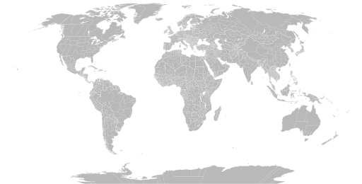
English: A detailed Robinson projection SVG map of the world with secondary political units grouped for easy coloring. |
| 日期 | |
| 來源 | |
| 作者 |
|
授權條款
我,本作品的著作權持有者,決定用以下授權條款發佈本作品:
| 此檔案在創用CC CC0 1.0 通用公有領域貢獻宣告之下分發。 | |
| 在此宣告之下分發本作品者,已依據各國著作權法,在全世界放棄其對本作品所擁有的著作權及所有相關相似的法律權利,從而將本作品貢獻至公有領域。您可以複製、修改、分發和演示該作品,用於任何商業用途,所有這些都不需要請求授權。
|
檔案歷史
點選日期/時間以檢視該時間的檔案版本。
| 日期/時間 | 縮圖 | 尺寸 | 用戶 | 備註 | |
|---|---|---|---|---|---|
| 目前 | 2024年6月25日 (二) 08:02 | | 512 × 260(9.25 MB) | ClaveScottPH | Fixed. |
| 2024年6月22日 (六) 02:08 |  | 512 × 260(3.45 MB) | ClaveScottPH | Fixed colors for comoros, fixed overlapping for Abkhazia, and added subdivisions for Bahrain. | |
| 2024年6月20日 (四) 14:06 |  | 512 × 260(2.47 MB) | ClaveScottPH | Fixed division for the Central African Republic, Montenegro, and Thailand; fixed overlapping divisions for Morocco, Nigeria, Palestine, South Ossetia (disputed), and Taiwan (disputed). | |
| 2024年6月10日 (一) 06:50 |  | 512 × 260(2.42 MB) | ClaveScottPH | Fixed | |
| 2024年6月10日 (一) 04:01 |  | 3,413 × 1,752(5.9 MB) | ClaveScottPH | {{subst:update-note|1=File:Blank Map World Secondary Political Divisions.svg|2=new cantons in Luxembourg, municipalities in Latvia, new regions in Chile, Tanzania, the Philippines, Mali, Kazakhstan, Ghana, and Ethiopia, new prefectures in the Central African Republic, new provinces in Equatorial Guinea, Burundi, Algeria, Laos, Indonesia, Nepal, and the Democratic Republic of the Congo, new governorates in Lebanon and Oman, new administrative area in South Sudan have been created.}} ~~~~ | |
| 2022年5月28日 (六) 19:10 |  | 2,560 × 1,314(4.59 MB) | Betseg | Reverted to version as of 00:32, 13 March 2022 (UTC). Nearly double the size because of the high detailed divisions, and the colours were broken. | |
| 2022年5月7日 (六) 21:47 |  | 2,560 × 1,314(7.27 MB) | Abbasi786786 | Made Pakistan and Nigeria more precise; Added new Congolese provinces | |
| 2022年3月13日 (日) 00:32 |  | 2,560 × 1,314(4.59 MB) | Abbasi786786 | Merged KPK and former FATA, Pakistan | |
| 2021年12月13日 (一) 11:20 |  | 2,560 × 1,314(4.59 MB) | W0nderhat | Reverted to version as of 18:26, 6 June 2020 (UTC); removal of Chilean Patagonia unnecessary and confusing, ISO codes an unfortunate casualty (will look into how to restore them) | |
| 2020年9月20日 (日) 20:39 |  | 2,560 × 1,314(4.27 MB) | Hoehermann | Added or adjusted ISO-3166 codes for Mexico, Morocco, USA, Antarctica, Cuba, Greenland. Separated Antarctica from Chile. Removed comments. |
檔案用途
下列2個頁面有用到此檔案:
全域檔案使用狀況
以下其他 wiki 使用了這個檔案:
- bn.wikipedia.org 的使用狀況
- bs.wikipedia.org 的使用狀況
- en.wikipedia.org 的使用狀況
- Government
- Administrative division
- Wikipedia:Blank maps
- Wikipedia:Graphics Lab/Map workshop/Archive/May 2011
- User:Naqsh-e hJahan/List of provinces
- User talk:Naqsh-e hJahan/List of provinces
- Wikipedia:Graphics Lab/Illustration workshop/Archive/Jun 2023
- Wikipedia:Graphics Lab/Map workshop/Archive/Jul 2023
- ja.wikipedia.org 的使用狀況
- ne.wikipedia.org 的使用狀況
- sq.wikipedia.org 的使用狀況
- sr.wikipedia.org 的使用狀況
- te.wikipedia.org 的使用狀況
- tr.wikipedia.org 的使用狀況