
File:Monashee Mountains2.jpg
原始檔案 (1,155 × 1,192 像素,檔案大小:780 KB,MIME 類型:image/jpeg)
摘要
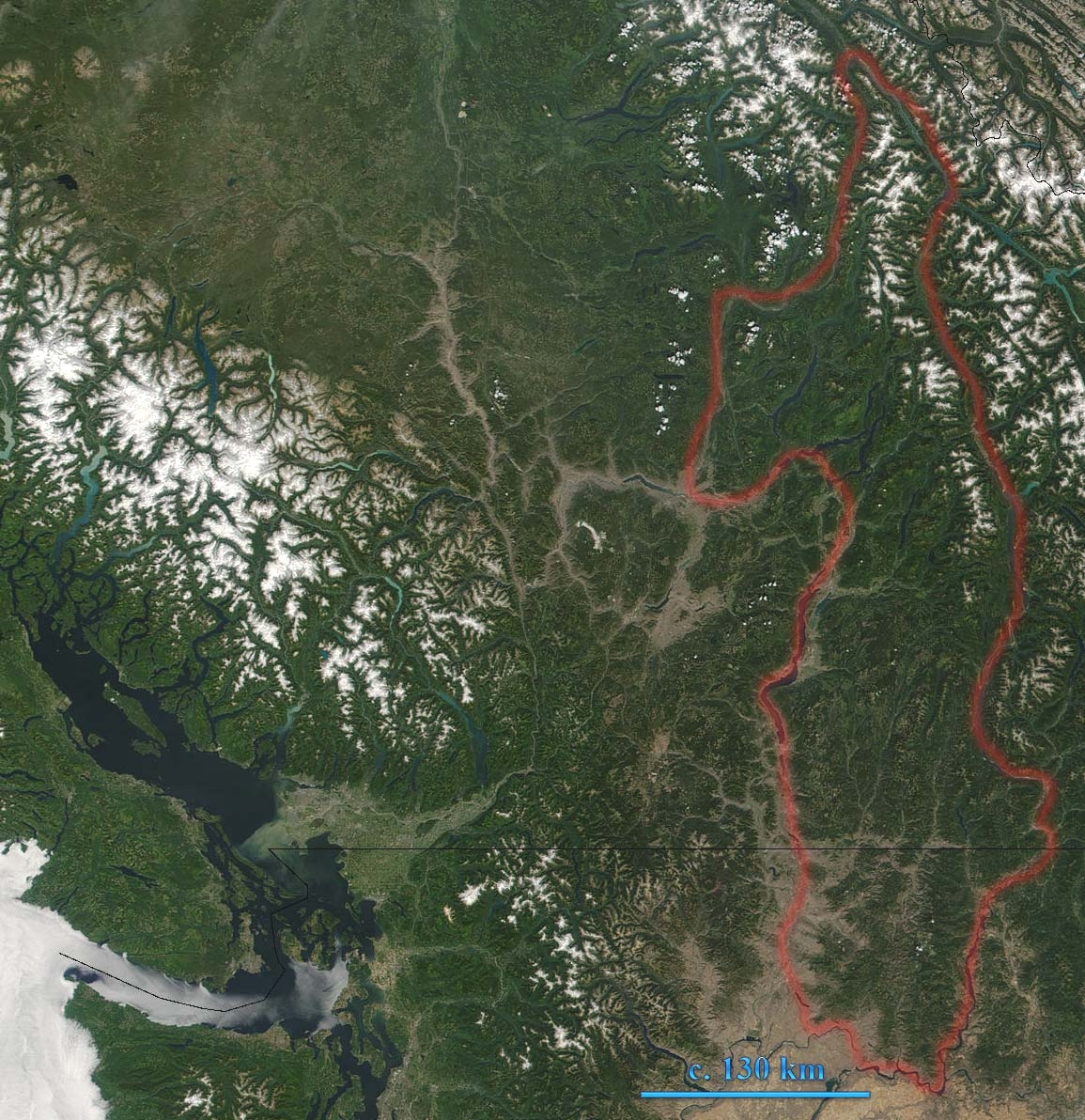
Monashee Mountains in British Columbia, Canada are indicated. The boundary shown includes the Okanagan Highland and the southeastern Shuswap Highland, which are sometimes reckoned to be part of the Interior Plateau. This true-color MODIS image shows southern British Columbia. In the left of the image lies Vancouver Island, which is separated from Washington by the Juan de Fuca Strait. British Columbia's glacier-capped Coast Mountain Range runs northwest-southeast inland from Vancouver Island.
Source: [1] archive copy at the Wayback Machine
Modified by User:Skookum1 from original Image:Monashee Mountains.jpg- image brightened for better visibility
授權條款
| 本作品由NASA創作,屬於公有領域。根據NASA的版權政策:“NASA的創作除非另有聲明否則不受版權保護。”(參見:Template:PD-USGov/zh,NASA版權政策或JPL圖像使用政策) | ||
 |
警告:
|
檔案歷史
點選日期/時間以檢視該時間的檔案版本。
| 日期/時間 | 縮圖 | 尺寸 | 用戶 | 備註 | |
|---|---|---|---|---|---|
| 目前 | 2007年1月9日 (二) 22:26 | | 1,155 × 1,192(780 KB) | Skookum1 | Monashee Mountains in British Columbia, Canada are indicated. This true-color MODIS image shows southern British Columbia. In the left of the image lies Vancouver Island, which is separated from Washington by the Juan de Fuca Strait. British Columbia's gl |
檔案用途
下列頁面有用到此檔案:
全域檔案使用狀況
以下其他 wiki 使用了這個檔案:
- en.wikipedia.org 的使用狀況