
File:Ophir Chasma.jpg
預覽大小:569 × 600 像素。 其他解析度:228 × 240 像素 | 455 × 480 像素 | 729 × 768 像素 | 972 × 1,024 像素 | 2,438 × 2,569 像素。
原始檔案 (2,438 × 2,569 像素,檔案大小:778 KB,MIME 類型:image/jpeg)
摘要
| 描述 |
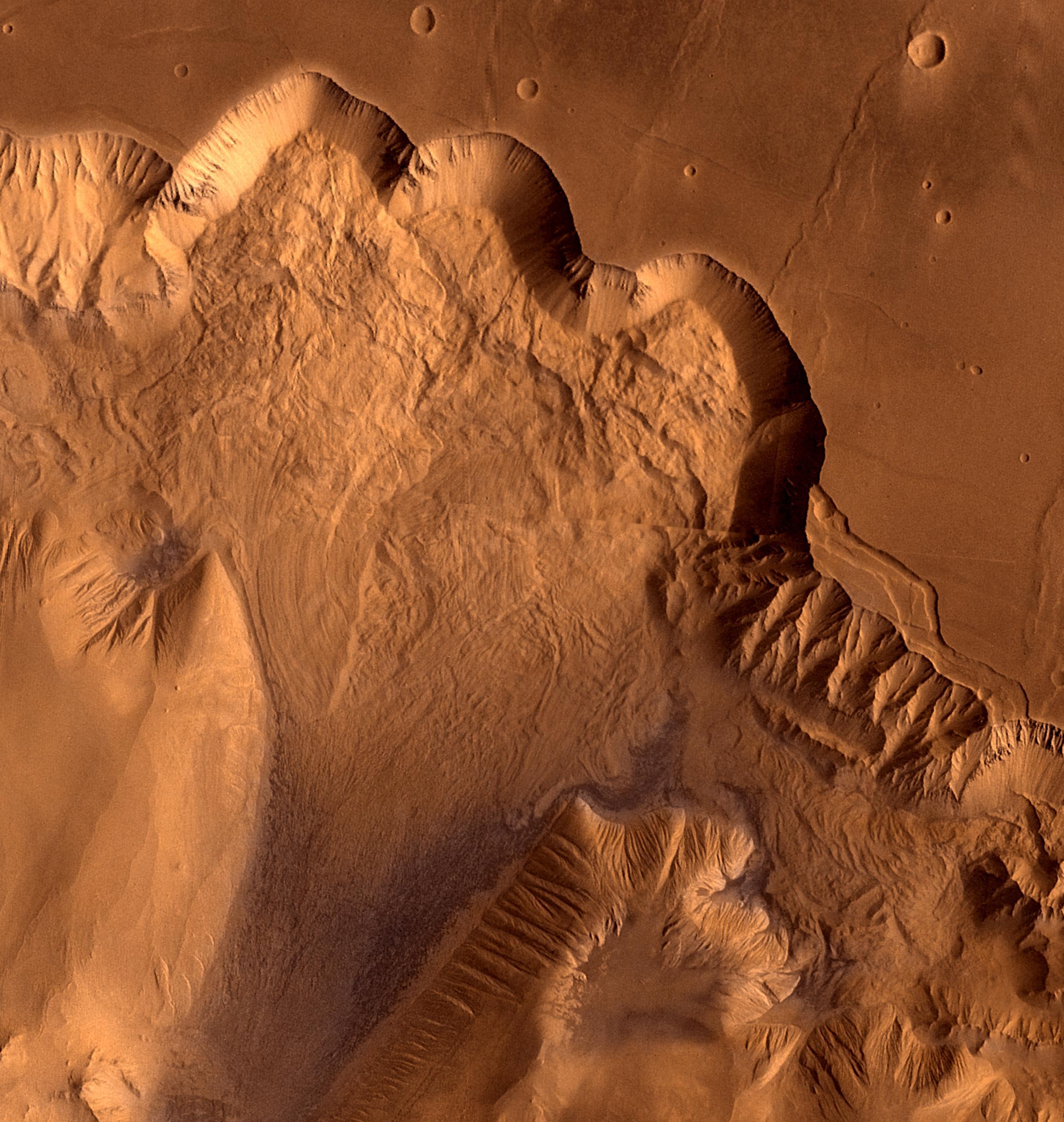
English: This synthetic oblique view shows Ophir Chasma, the northern most one of the connected valleys of Valles Marineris. For scale, the large impact crater in the right corner is about 30 km wide.
Ophir Chasma is a large west-northwest-trending trough about 100 km wide. The Chasma is bordered by high-walled cliffs, most likely faults, that show spur-and-gully morphology and smooth sections. The walls have been dissected by landslides forming re-entrants. The volume of the landslide debris is more than 1,000 times greater than that from the May 18, 1980, debris avalanche from Mount St. Helens. The longitudinal grooves seen in the foreground are thought to be due to differential shear and lateral spreading at high velocities. |
| 日期 | |
| 來源 | NASA Image of the Day |
| 作者 | NASA/JPL/USGS |
授權條款
| 本作品由NASA創作,屬於公有領域。根據NASA的版權政策:“NASA的創作除非另有聲明否則不受版權保護。”(參見:Template:PD-USGov/zh,NASA版權政策或JPL圖像使用政策) | ||
 |
警告:
|
檔案歷史
點選日期/時間以檢視該時間的檔案版本。
| 日期/時間 | 縮圖 | 尺寸 | 用戶 | 備註 | |
|---|---|---|---|---|---|
| 目前 | 2011年8月22日 (一) 18:54 | | 2,438 × 2,569(778 KB) | Originalwana | {{Information |Description ={{en|1=This synthetic oblique view shows Ophir Chasma, the northern most one of the connected valleys of Valles Marineris. For scale, the large impact crater in lower right corner is about 30 km wide. Ophir Chasma is a larg |
檔案用途
下列頁面有用到此檔案:
全域檔案使用狀況
以下其他 wiki 使用了這個檔案:
- en.wikipedia.org 的使用狀況
- it.wikipedia.org 的使用狀況
- www.wikidata.org 的使用狀況