
File:St George Island Fl.png
此為最大尺寸。
St_George_Island_Fl.png (487 × 372 像素,檔案大小:36 KB,MIME 類型:image/png)
Transwiki approved by: w:en:User:Dmcdevit
This image was copied from wikipedia:en. The original description was:
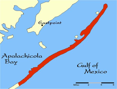
本地圖取自美國國家地圖集的某個版本。國家地圖集的絕大多數作品是美國聯邦政府的作品,因此屬於公有領域。
連結網址︰ NationalAtlas.gov | 1970年印刷版︰ 國會檔案館, Perry-Castañeda圖書館
|
I don’t know where to put a talk issue: why is only part of the island red? What does the red signify?
原始上傳日誌
| date/time | username | resolution | size | edit summary |
|---|---|---|---|---|
| 16:17, 15 May 2006 | w:en:User:Noles1984 | 487×372 | 36 KB | {{PD-USGov-Atlas}} <a href="/wiki/Category:Florida_maps" title="Category:Florida maps">Category:Florida maps</a> |
Image description page history
| link | date/time | username | edit summary |
|---|---|---|---|
| http://en.wikipedia.org/w/index.php?title=Image:St_George_Island_Fl.png&redirect=no&oldid=53336011 | 07:27, 10 September 2007 | w:en:User:Dmcdevit | |
| http://en.wikipedia.org/w/index.php?title=Image:St_George_Island_Fl.png&redirect=no&oldid=53336011 | 16:17, 15 May 2006 | w:en:User:Noles1984 | ({{PD-USGov-Atlas}} <a href="/wiki/Category:Florida_maps" title="Category:Florida maps">Category:Florida maps</a>) |
檔案歷史
點選日期/時間以檢視該時間的檔案版本。
| 日期/時間 | 縮圖 | 尺寸 | 使用者 | 備註 | |
|---|---|---|---|---|---|
| 目前 | 2007年9月10日 (一) 16:39 | | 487 × 372(36 KB) | BetacommandBot | Transwiki approved by: w:en:User:Dmcdevit This image was copied from wikipedia:en. The original description was: {{PD-USGov-Atlas}} w:en:Category:Florida maps === File history === {| class=wikitable ! date/time || username || resolution || siz |
檔案用途
下列頁面有用到此檔案:
全域檔案使用狀況
以下其他 wiki 使用了這個檔案:
- de.wikipedia.org 的使用狀況
- en.wikipedia.org 的使用狀況
- fr.wikipedia.org 的使用狀況